| Category | Valleys |
| Continent | Brucrumus |
| Region | Cinazan |
| Map | Sahânzar Valley |
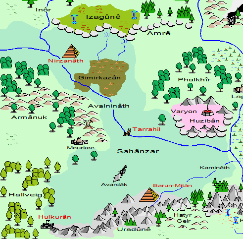
Sahânzar is a fertile basin stretching across two regions of Cinazan. A thousand years ago the Nermanis Sea covered this area. In the Onyx Enmity War (915 - 920), a great war was waged in caverns beneath this sea. In one of the battles, a great hole was opened in Zarag-Gûn. This cavern's ceiling, close to a seabed above, led to the draining of the Nermanis Sea. The old sea bottom became a vast fertile basin. Today, the rich soils of the area provide enormous amounts of food for the Khazarkar Empire. The slopes of the basin are terraced and have numerous man-made lakes, ponds, and waterfalls. Many mills are scattered about the tracts of forests in the gently descending slopes of the terrain. These are newer woodlands, harvested and tended by foresters and druids of the Khazarkar Empire.
Along the edge of Sahânzar, once the shores of a freshwater sea, are the ruins of the Nermanis Syndicate.
The hole that opens into Zarag-Gûn has expanded over the centuries, forming a deep canyon called Avardâk. Rains and run-off from rice paddies and farms spill into this canyon. During the rainy season, this forms a shallow lake some 600' down into the canyon. The water only lasts several weeks before draining into the dark reaches of Faeglor.
The largest settlement in Sahânzar is the city of Nirzanâth. It competes with Barun-Mitân to produce grain and other foodstuffs for the Khazarkar Empire. Together, these two cities are the largest grain producers on Brucrumus. By way of these two cities, the farms and fields of Sahânzar feed the entire population of the Khazarkar Empire.
The annual thawing and melting of the southern reaches of Ice Cap results in the eastern part of Sahânzar becoming inundated with water. This flood zone is twenty miles east of Avardâk and covers the basin all the way west to Orondir. During this Ice Cap Melt, the Dargirth crests around the beginning of Bloom.